


The Discovery Trail - Anza-Borrego
- May 25, 2025
- 4 min read
Updated: Aug 25, 2025
With over 500 miles of roads and trails, Anza-Borrego is one of Southern California’s premier destinations for overlanding and off-roading. Spanning 600,000 acres, this vast desert wilderness features diverse terrain—washes, rugged badlands, winding slot canyons, towering mud palisades, and lush palm oases—all waiting to be explored. Nestled in the northern reaches of the Sonoran Desert, Anza-Borrego delivers dramatic landscapes that captivate adventurers and nature enthusiasts alike.

Anza-Borrego: A Unique Overlanding Experience
If you are an off-roading fan, Anza-Borrego offers an exceptional experience. The area's rugged beauty is perfect for thrill-seekers. The scenic views and challenging terrains provide the ultimate adventure. Whether you're an experienced driver or a newcomer, you can enjoy endless exploration.
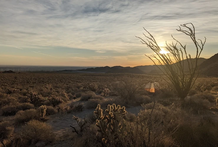
Desert | Overland | Scenic | Iconic | Sand |
Route Overview
Trip Length & Season
Adventure Rating: Epic
Trip Length: 4-6 days / 216 Miles
Season: The best time to visit is from October through early May. Spring blooms peak in March and April. Summer travel is discouraged due to extreme temperatures up to 115°F
Digital Maps & GPX Files
Anza-Borrego Trail
If you need help with digital maps and GPX files, please check out our soon-to-be *FAQ section

Technical Rating & Terrain
Average Technical Rating: 2-3
Peak Technical Rating: 4
Typical Terrain: The trails feature a mix of washes with deep silt, sandy jeep tracks, and graded dirt roads that may have washboards. Some areas require steep descents where engaging 4WD low is advised, especially in regions like Diablo and Borrego Mountain Wash Drop-off and Piepkorn Slot
One Way Trails
There are two "drop offs" along the route, both of which are one way to ensure safety on the trail. It’s recommended to start near the town of Ocotillo and proceed north.
Recommended Vehicle Types
Recommended Vehicle: Stock 4x4
Recommended Moto: A mid-sized or dual-sport bike is recommended due to sandy areas
Adventure Vans: Sprinter 4x4s aren’t suitable for this track
Gear, Fuel, and Provisions
Fuel: Ocotillo to Borrego Springs is 150-170 miles, and Borrego Springs to Salton City is 70 miles
Provisions: Available near fuel stations
Gear: Not applicable
Alternative Routes
Piepkorn Slot Bypass
Distance: 6 miles
Technical Rating: 2
Use this route to bypass the steep descent down the Piepkorn Slot, which is rated a 4.
Camping Recommendations
Anza-Borrego and Ocotillo Wells offer endless backcountry camping opportunities. Familiarize yourself with Anza-Borrego's campfire rules (fires must be in a metal container). As of this route's publication, all fires in Ocotillo Wells must be in a steel fire ring.
Favorite Camping Spots
Mortero Canyon
Vallecito Wash
Hollywood & Vine Campsite
Fish Creek Wash
Clark Dry Lake
Fonts Point Plateau
Volcanic Hills Vicinity
Piedras Grandes Vicinity
Way-points of Interest
Arroyo Tapiado Mud Caves
Borrego Mountain Wash Drop-off
Borrego Springs
Canyon Sin Nombre
Clark Dry Lake
Diablo Drop Off
Elephant Knees
Fish Creek Wash
Fonts Badlands / Inspiration Wash
10. Fonts Badlands Sunrise Viewpoint
11. Fonts Point
12. Galleta Meadows Metal Sculptures
13. Gas Domes
14. Great Southern Overland Stage Route
15. Montero Palms
16. Mud Palisades
17. Painted Gorge
18. Piepkorn Slot
19. Piedras Grandes
20. Pumpkin Patch
21. Rockhouse Canyon
22. Sandstone Canyon
23. Seventeen Palms Spring
24. Shell Reef
25. Tectonic Gorge
26. The Slot
27. Volcanic Hills
28. Water Tower con Dos Cabezas
29. Wind Caves
Land Managers/Resource Materials
Land Managers
Other Resources
Permits
There is a fee to enter Anza-Borrego State Park ( more info ). Ocotillo Wells does not charge fees for entrance or camping.
Route Details
Travel Direction
This route is best traveled from south to north because of two one-way sections at Diablo Drop-off and Borrego Mountain Wash Drop-off.
The Anza-Borrego Discovery Trail covers over 200 miles of rugged roads and trails throughout Anza-Borrego Desert State Park and parts of Ocotillo Wells SVRA. This park is California’s largest, spanning over 600,000 acres. It attracts outdoor lovers, nature enthusiasts, and off-road adventurers year-round. The park gradually transitions from the Sonoran Desert into the Mojave Desert as you head north. The Peninsular mountain ranges capture moisture from passing storms, creating a stunning landscape of badlands, slot canyons, winding washes, and palm-lined oases.
Wildlife Watching: Stargazing, hiking, mountain biking, and wildlife observation are popular outdoor activities. Late February to March is prime wildflower season, especially in wetter years.
Historical Background: Anza-Borrego and Ocotillo Wells were once submerged under the Gulf of California's waters, which extended as far as Palm Springs. Evidence of this marine past remains in formations like Shell Reef and Mollusk Wash.
The path offers a mix of technical and mild sections. Vehicle requirements include 4x4 capabilities with a 2-inch lift and 32-inch tires. While seasoned drivers can navigate confidently, novice drivers should collaborate with experienced companions, especially on challenging spots.
Canyon Sin Nombre: Also known as the "Canyon with No Name," it showcases rock formations aged over 500 million years.
Adventure Awaits
Expect a thrilling adventure through stunning terrains. Along the journey, drivers will meet vibrant plant life and breathtaking views. For those preferring exploration on foot, many discovery points require short hikes. Longer treks, such as Rockhouse Canyon, are also available.
Dive deep into the wilderness; Anza-Borrego is waiting for you.
Gallery


Terms Of Use: Should you decide to travel a route that is published on 12degnorth.com, you do so at your own risk. Always take appropriate precautions when planning and traveling. Check for the current local weather, permit requirements, trail conditions, and land closures. While traveling, obey all public and private land use restrictions and rules. Carry appropriate safety, recovery, and navigational equipment. The information found on this site is a planning resource meant to inspire your own due diligence.

12° NORTH INDUSTRIES
Sales: 702.781.0302
Email: sales@12degnorth.com
Website: www.12degnorth.com


Comments